Interactive Map Features
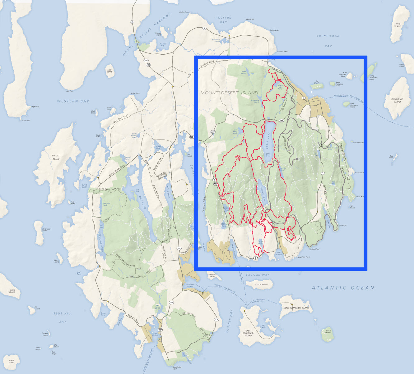 RouteFinder displays routes on an interactive map of the east side of Mount Desert Island where the
the carriage roads are located. The blue outline at right shows the area that the RouteFinder map covers.
RouteFinder displays routes on an interactive map of the east side of Mount Desert Island where the
the carriage roads are located. The blue outline at right shows the area that the RouteFinder map covers.
Map Markers
The interactive map does much more than display routes. It has more than 100 markers that you can click or
touch to get information about or see a photograph of the following:
- Carriage road access points (14)
- Carriage road bridges (17)
- Motor road bridges (11)
- Carriage road signposts (41)
- Trailheads (27)
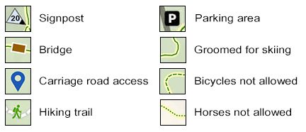
Map Legend
A legend for the map is shown below. The markers in the left column are touchable/clickable. The ones in
the right column are informational.
Map Directory

If you are interested in a particular location
but don't know where it is on the map, you can search for it in the map directory.
To open the directory, click or touch the "hamburger" icon located in the upper-left corner of the map.
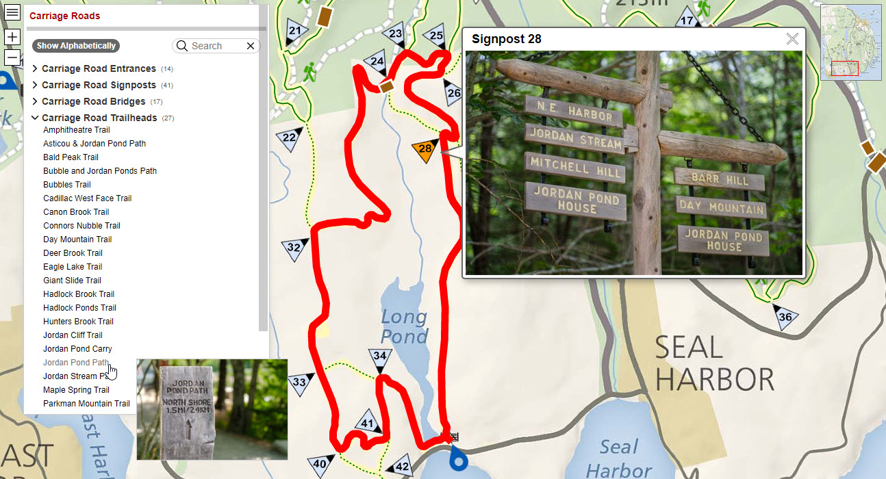
Below is a screenshot showing the directory expanded to list carriage road trailheads. The mouse is over
the Jordan Pond Path item and a preview of that trailhead is showing. The marker for signpost 28 was clicked
to show a popup with a photograph of signs at that intersection. The upper-right
corner of the map has an inset showing which portion of the zoomed-in map is currently visible.
The screenshot above was taken with RouteFinder running on a desktop computer with a monitor that has plenty
of room to show the map, directory, and popup information. On small mobile devices, the information associated
with a marker slides up from the bottom of the map and is expandable.
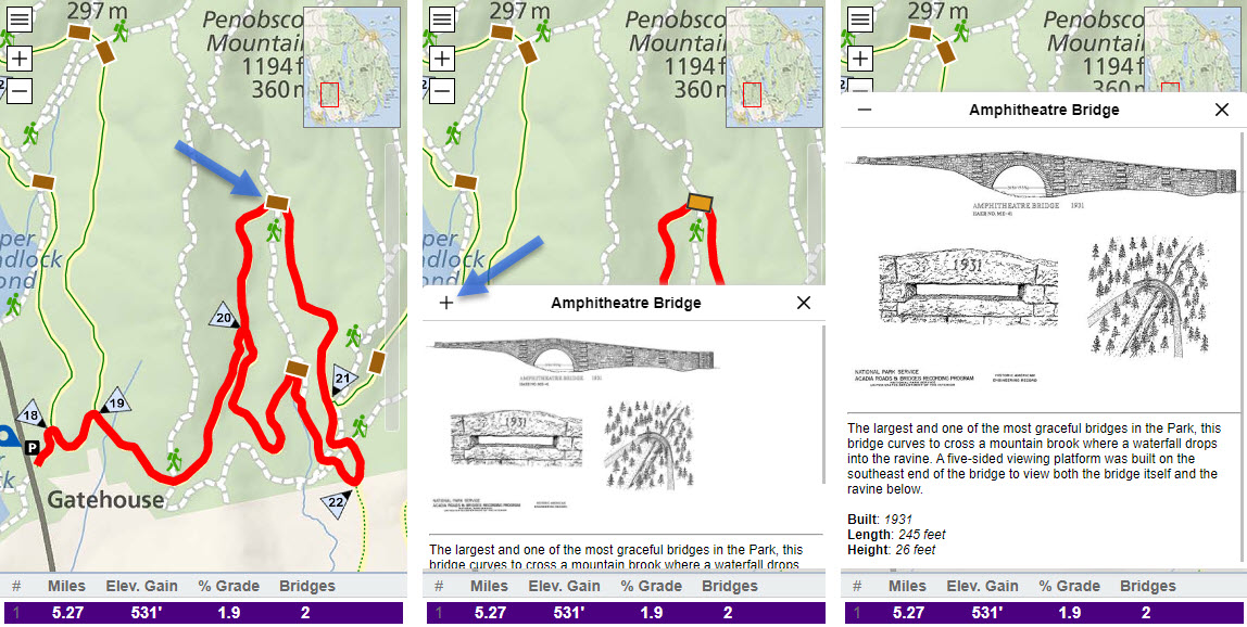
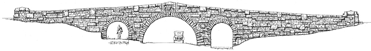
In the screenshot below, the left image is
annotated with a blue arrow to show where you could touch the marker for the Amphitheatre Bride. The middle
image shows the information about the bridge in a slide-up panel. The middle image is also annotated with a blue
arrow to show where you can touch the "+" icon to expand the panel as shown in the right image.